Sunday, July 24, 2011

Prospector Campground, Colorado


We took the Tabelot on a great adventure for our first camping trip to Colorodo.  The Rocky Mountains are beautiful! We stayed at the Prospector Campground outside of Frisco.  The campground is conveniently located off of I-70 and near the highway out to Breckenridge.  The area had incurred some pine beetle damage, but the scenery was still breathtaking.

View of Prospector Campground
 Our friend Karla came along for the weekend so we could all do some training hikes for our upcoming trip to Kilimanjaro.  I think the weekend was a great success.  We managed to climb 4 peaks above 14,000' in two days.  On Saturday we got up at 0-dark-hundred to force down some breakfast and then drove about an hour to the Kite Lake Trailhead.  We arrived with droves of other excited hikers, up early to tackle the big peaks before the afternoon storms rolled in. 

Start of Mount Lincoln Trail

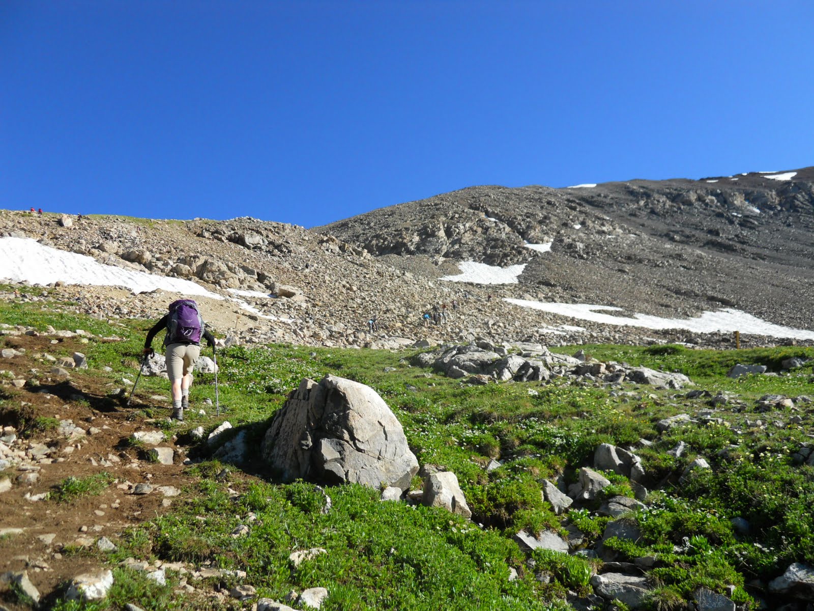
We were on the trail by 8:00 a.m. (which as a bit later than we wanted, but better than it could have been).  The trail starts above the treeline at 12,000' in a beautiful alpine meadow.  Kite Lake is the trailhead for four peaks in the area, inlcuding Mt. Democrat (14,148'), Mt. Cameron (14,238'), Mt. Lincoln (14,286') and Mt. Bross (14,172').  We didn't do Mt. Democrat, but we managed to do the Cam-Lin-Bro loop which hits three of the peaks with pretty easy access across broad saddles and expansive views.
Karla heading up to the first saddle

Three of us on top of Mt. Lincoln

The next day we drove further east to do Grays Peak.  The Grays Peak trailhead was just as crowded as the Kite Lake trailhead with lots of people heading out on a beautiful but crisp morning.  Grays Peak was a great hike and an amazing climb up the scree switchbacks that seemed to go on forever.  Here are some of my favorite shots from our hike up Grays.


Heading up the Valley

Mary near the final ascent

Three of us on top of Grays Peak


Sunday, June 26, 2011

Uintas - Lower Provo Dispersed

We finally made it up to the mountains this weekend, after waiting for spring to give way to summer this year.  Many of the lower campgrounds were closed due to flood warnings, but we found a great spot in the "dispersed" campsites above the Lower Provo Campground.  These "dispersed" campsites are great!!  They are improved sites with a flat area for the trailer and a fire pit, but no water or restrooms.  Best part is that they are free! 

North Fork of the Provo River
We had to keep our hiking to the lower trails as the snow levels above 9,000' were prohibitive.  On Friday evening, we hiked a couple miles in on the North Fork Trail.  Usually this trail can be done as a loop, but you can see from the picture above that a river crossing was impossible.  I have never seen this river so high.  It was incredible. 


On Saturday we did the Yellow Pine Creek Trail.  This was a pretty nice hike up a drainage following the creek.  The dogs loved all the water.  We didn't make it all the way to the Yellow Pine Lakes due to snow at the top and some difficult route finding, but it was a great day in the mountains.


The turn-around point, somewhere below Castle Peak

For the final wrap up on Sunday we did another new hike to Sunset Ponds.  We had three different maps of the area (as I like to be well prepared and do comparison research).  Sunset was only shown on one of the three maps, and it was NOT on the official map of the Kamas Ranger District.  Needless to say, it was a bit "primitive" from years of disuse.  But it was great for us, as NO ONE was on the trail.  We also got to practice our climbing and ducking abilities with the packs to get over all the tree falls across the trail.  We thought with the name "Sunset" that we would get to an overlook that was nice to see the sunset.  Instead, we were pleasantly surprised to get to the top and have a little lake.  So, now we call this one "Sunset Ponds." 
This is the start of the Sunset Trail (a little wet this year)

Mary taking a break with the dogs

Nice views before the top

Sunset Ponds


Monday, May 9, 2011

Zion National Park, Utah

We went camping this weekend in Springdale, Utah, just outside of Zion National Park.  It was a gorgeous weekend with consistently sunny weather.  We stayed at the Zion Campground RV Park located just half a mile from the entrance to the National Park.  The campground spots were tightly packed, but everyone in the park was extremely nice and we had a great time chatting with others about their adventures.  Some people park their big rigs here for the whole summer.  You can't beat the location.  We were lucky enough to get a spot right by the river - which happened to be raging this time of year at over 800 cfs.
We used to visit Zion on our family road trips from California to Utah, but I guess I had never really explored the hiking opportunities in the park like we did on this trip.  We logged in 38 miles over five days.  It was amazing.  The variety of the terrain and scenery was surprising and the vistas were just spectacular.  I can't wait to get back and do some more exploring and hiking in the backcountry.

On one of our hikes, we managed to make it to the top of Angels Landing, a ridiculous hike up a fin of red sandstone with 2,000' drop offs on either side.  It actually took me two tries to make it to the top.  The day before, I chickened out.  My pride got the best of me though, and I had to come back the next day to conquer the beast.  Some people scramble up this precipice like it is candy, while others of us slink up it like primordial monkeys, keeping our limbs and gravity as low as possible to the ground.  I'm just glad I lived to tell about it. 


Near the top of Angels Landing, where the views of the cliff walls and Virgin River Canyon below was just spectacular, we overheard a woman talking to her friends.  I just loved her comment.  She said, "I'm not an environmentalist, but I'm glad someone is."  Classic.


My favorite hike of the weekend was the out and back on the West Rim trail.  This is one of those epic hikes through red rock cliffs, white sandstone rims, and 1,000' waterfalls glittering the canyon walls.  Amazing scenery.  Parts of this trail are paved and even chiseled out of the cliff wall as leftover remnants of the work done by the Civilian Conservation Corps (CCC) back in the 1930's. 
Mary heading up the West Rim Trail
View of the West Rim from Telephone Canyon
View from West Rim Spring
I couldn't pass up this shot.
Pause for Peace.

For our final hike, we did Observation Point.  This is an 8 mile hike with about 2,100' of elevation gain through Echo Canyon and then out onto a windy ridge.  The trail seemed interminable.  The winds up on top were so strong we though we might get blown right over the edge.  Needless to say, we did not spend much time at the top!

Lisa at the top of Observation Point
What an amazing place. 
Lisa and Mary - Self Portrait

Sunday, May 1, 2011

San Rafael Swell, Again

We made a quick trip down to the Swell to retrieve the T@b. Luckily she was sitting right where we had left her, with a few more drainage trails from all the rain. We did a great hike along the San Rafael River from the Bridge to the mouth of the Little Grand Canyon.
We made it in about 3 1/2 miles and then turned around. Next time we will come in from the Fuller Bottom trailhead to check out the other side of the trail. The scenery along the river was beautiful.  
 We are starting to appreciate what this place has to offer (other than rain and wind). It was also amazingly serene and quiet this time down. I think last weekend was unusually crowded since it was Easter Weekend. We pretty much had the place to ourselves this time. 

Sunday, April 24, 2011

San Rafael Swell, Utah


We went camping in the San Rafael Swell this weekend.  Thanks to a tip from some friends, we found a great campsite off of Mexican Mountain Road tucked up into the red cliffs with a fantastic view of the river valley.  It was a rainy weekend with temperatures cooler than normal for this time of year.  That seems to be the weather report for this entire spring.  We woke up one morning to snow on the ridges!  Despite the weather, we managed to do some exploring and to get a few hikes in between the storms. 


Our first hike was a quick out and back to the river overlook on the Lockhart Box trail. This was a pretty primative trail with required route finding skills near the top, but the overlook was great. Some people do this as a loop trail with a 10 mile float down the river and a two mile hike back to the road on the Upper Black Box trail.


Saturday we waited for the rain to clear and then drove out to the Buckhorn Wash art panel to check out some great pictographs from the Barrier Culture. These pictographs are thought to be about 2,000 years old. It is amazing that they are still in such good shape after thousands of years.


After the pictographs, we drove out in the mud to the Wedge Overlook.  This view almost rivals the Grand Canyon.  It really is spectacular.  And definitely not as crowded on a chilly spring morning.  As you can see from the pictures, we are pretty bundled up for a trip down south in the end of April.  We have the gear though, so might was well use it.
After a quick lunch back at camp, we drove out to do the Calf, Cow and Pine Canyon hikes.  These little out and back canyons are great.  I would definitely do these hikes again.  Calf Canyon seemed a little longer than the book said.  Combined, these canyons are about a 6 mile hike.  The afternoon weather cleared enough for a really nice hike.


When we were just finishing the Calf, Cow and Pine Canyons hike, we passed some people who said they just saw a bighorn sheep cross the path and climb up the other ridge.  We rushed up the trail to see if we could get a glimpse of the bighorn, but he was gone.  We did get to see a really nice rainbow though on on the drive back to camp.
 

Sunday it rained again.  Harder than the day before.  The roads were a complete muddy mess.  We decided to leave the T@b and just head out in the truck.  We'll have to come back next weekend to pick her up, but it was nice not to have to worry about getting stuck in the mud. 

Saturday, April 16, 2011

Hiking, Hiking, Hiking

This T@b year is going to be dominated by our quest to hike as much as we can.  We have signed up for a trip to Tanzania to climb Mount Kilimanjaro in September.  Kilimanjaro is about 19,300' high, so we will need to do some altitude training as well.  If anyone has any favorite camping spots and hiking trails in Colorado that they are willing to share that would be great.  We are looking to do some 14,000' peaks in July or August.  Until then, we will be taking the T@b out to the local mountains in Utah as much as we can.  We just have to wait for the record snow pack to melt. 

You can track our training progress at my other blog kilimanjambo.blogspot.com