Showing posts with label tab trailer. Show all posts

Tuesday, April 14, 2015

New Cushion Covers

We had some new cushion covers made this year for the Tab.  We got the fabric at Ikea.  I had hoped to make the bottom covers out of red, but we couldn't find a sufficient match so we went with the faces on the top and bottom cushions.  Sometimes the faces seem a little creepy, but most of the times they are cheerful and add a fun element to the Tab.  Definitely a unique addition.

Yuba Lake State Park

We bought a new kayak!  So, we set out for Yuba Lake for the maiden voyage.  It was another fun quick getaway.  The park is pretty exposed with very few trees and plenty of wind, but it was still fun to explore the trails and to try out the kayak on the choppy water.  

Willard Bay State Park

We started the 2015 season off with a quick trip to Willard Bay State Park.  We were hoping to go to Antelope Island but that park was full.  It has been a very mild winter and everyone is starting the camping season early.  Willard Bay was a nice little campground with big trees and interactive trails through the cat tails.  The downsides were the noise from the campground's proximity to the freeway and the gnats and mosquitos that came out in force as dusk.  

Friday, June 15, 2012

Onion Creek Dispersed, Moab

We went down to Moab this weekend to check out the status of the cabin construction.  We pulled into town around 5:30 p.m. and it was sweltering hot.  We were surprised to find one of the dispersed campsites along Onion Creek available.  Usually these spots are all taken.  It is a gorgeous site right along the creek so the dogs can cool off whenever they want.  Turns out no one was out here because it is just too hot.  We thought it would cool off in the evening, but it just seemed to get hotter!  Darwin slept outside under the trailer -- which seemed to be the coolest spot.  We managed to survive the night, but decided to head to the La Sals for the rest of the weekend.
Onion Creek

Heading Out


Sunday, April 29, 2012

Spring Cleaning with Autobond

We didn't get to go out of town this weekend, so I decided to do a little spring cleaning on the T@b.  I cleaned all the bird poop, sap and road grime off of every nook and cranny and then waxed her with a liquid wax called Autobond.  This stuff was recommended by someone on the T@b groups website.  It was easy to use and buffed out easier than other liquid waxes I have used in the past.  I definitely recommend Autobond if you want your T@b to look sparkling new.  She looks like she did the first day we drove her home.

Saturday, April 7, 2012

Fremont Indian State Park

During the construction of I-70 through the central part of Utah in the 1980's, workers uncovered the ruins of a large fremont indian village with numerous pit houses, granaries, rock tools and other artifacts dating from around A.D. 400 through 1300.  Archaeologists were allowed to go in and document the structures and artifacts before the highway construction proceeded.  The highway was eventually constructed, and the remains of the village and other collected artifacts are now preserved in the Fremont Indian State Park Museum.  There is still a lot of rock art near the museum and along Clear Creak Canyon.  The petroglyphs are pretty accessible off of a loop trail that starts right from the museum. 
This was our second time visiting Fremont Indian State Park.  We met up with the professional campers again and stayed in the Sam Stowe Group Site (which is a great little secluded canyon with excellent facilities).  We had a nice time even though the weather was a little too cold.  Our summary for the weekend was:  Freezing-Cold-Sun-Wind-Freezing-Cold.  It got down to about 15 degrees at night, which is pretty darn cold for camping.  Everyone's waterline was frozen in the morning, with luckily, only minor damage reported.
Since it was so cold, we stayed huddled up at camp most of the time...went to bed early...and waited for the next meal.  Still a better weekend than staying home and doing chores.

Saturday, March 24, 2012

Hamburger Rock, Needles


We spent a great weekend in the Needles District of Canyonlands National Park.  We were hoping to get a spot at the Squaw Flats Campground inside the National Park, but by the time we got there (around 4:30 p.m. on Friday) the campground was full. The Ranger directed us to the closest campground outside of the park known as Hamburger Rock.  This campground is about 5 miles south of the park and 1 mile in on the dirt road to Lockhart Basin.  The campground only has 7 campsites nestled in and under the rock outcroppings of hamburger rock.  We were lucky enough to get the last spot in the campground (site #5).  The campground doesn't have any services, but does have a nice pit toilet, and each campsite has a fire ring and picnic table.
The Needles District of the Canyonlands National Park is known for its pointed rock formations resembling "needles."  I'm not sure I see the connection, but supposedly that is how the park got its name.  The park has some great vistas and a lot of anasazi indian ruins and petroglyphs.  The most famous petroglyph is Newspaper Rock.  We had a great time exploring the sites.
We didn't bring the dogs on this trip since they are not allowed on the trails in the National Park.  It was hard to leave them at home, but it sure freed up our time to hike and bike for as long and as far as we wanted. 
On Saturday, we attempted to bike Elephant Hill, one of the most difficult 4x4 routes in Utah.  This ride is insane.  It was frightening just walking the trail.  I can't even imagine trying to drive a vehicle up and over some of the rocks, stairs, drop-offs and cliffs encountered on this trail.  The only reason we did this ride is because it is in a mountain biking book I have that I bought back in 1990.  I am trying to ride every trail in the book, and Elephant Hill was on the list.  Needless to say, Elephant Hill is NOT listed in any of the mountain biking books printed today.

The author of the mountain biking book said it was "unclear" why the hill was called Elephant Hill and that its naming origins are uncertain.  After riding the trail, it is obvious how the hill got its name -- as it is one beast of climb that resembles going straight up an elephant's trunk, across its bumpy head, across its back, and then straight down its butt.  Case closed.  Despite the sheer terror of climbing and descending the elephant, the ride out to Devil's Kitchen and the backside Chestler Park was amazing with a great view of the needles area.  The ride was only 9 miles, but it took us about 3 hours to get through it.  I suppose I would do it again -- just for the views of Chestler Park -- and the adrenaline rush of walking your bike straight down an elephant's butt.


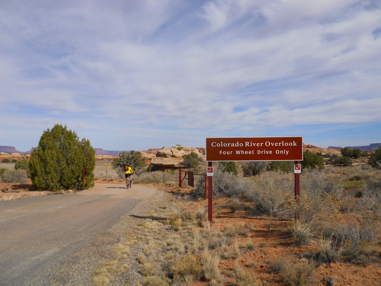
On Sunday, we did the much more reasonable Colorado Overlook ride.  This ride starts out at the Visitor's Center and follows a sandy dirt road across some desert meadows, accross Salt Creek, and then up a rocky embacnkment to an amazing overlook view of the Colorado River.  The ride wasn't as sandy this time of year and seemed easier than the last time we did it (7 years ago!).  The 14 mile out and back took us about 3 hours (including the time it took us to change a flat tire on my bike).


I can't wait to get back to Needles.  It was a great weekend and the scenery was stunning.  If Squaw Flats Campground is full again the next time we come, we might try staying at the Needles Outpost (a private campground just outside the park boundary), or just dry camping somewhere along Lockhart Basin road.  There were lots of great sites along this road, which appeared to be drivable with a trailer in tow for a couple of miles in from the main highway.
Conquered Elephant Hill

Wednesday, March 21, 2012

Water Tank Repair

Our fresh water tank has sprung a leak.  We were able to limp along for a couple of trips by putting duct tape over the hole, but the matter appears to be getting worse.  According to my research, these plastic tanks are suseptible to cracks and holes at the bottom corners as the tank expands and contracts with the pressure from the water pump.  Maybe I should have left the "bleed valve" open more, but I'm not sure the pump would have worked without the pressure.  Anyway, most blogs on this issue recommend just getting a new tank. While I would like to just get a new tank, I can't find the manufacturer or any distributor of a similar tank for the T@b and I don't want to have to special order one.  So, I am going to try one of the recommended temporary fixes. 
The most recommended products seem to be:  Eternabond (some type of roof sealant), J-B Waterweld (putty type product that works under water for marine type applications), and 911 (a rubberized spray).  I ordered the Eternabond (now called Sticknbond) off of the internet.  While they have a number of products, I just used the "roof vent kit" because it was the cheapest. 
Tank with Sticknbond patch
I put a small square of the stuff on the corner and pressed it into the plastic as hard as I could.  Then I put duct tape over the patch for good measure.  When I tested the patch for leaks, I realized I had patched the wrong corner!  I don't know how that happened!  Anway, I repeated the entire process on the leaking corner (try to do this the first time).  Refilled the tank with water and it appears to be holding! 
Patch covered with duct tape
While some websites recommended drilling a hole in the plastic on either side of the crack (to relieve the pressure from the crack), I did not do this.  It seemed too counterintuitive to me to make the small hole even bigger.  We'll see how long the fix lasts.  Much cheaper than a new tank.

Saturday, March 10, 2012

Lower Onion Creek, Moab

We went down to Moab this weekend for our first camping trip of 2012.  It was a beautiful weekend with highs in the 70s.  It was a bit chilly at night, with the lows in the the 30s, but we were happy to be out in the great outdoors.  We got down to Moab early enough on Friday afternoon to score one of the coveted camping spots at the Lower Onion Creek Campground.  There are only 5 camping sites in this little campground located near the Colorado River.  Onion Creek flows into the Colorado at the boundary of the campground making it a really picturesque spot. 
View from our campsite of the red cliffs and
snow covered La Sal Mountains off in the distance. 
The Lower Onion Creek Campground is tough to spot, unless you are looking for it.  The dirt road entryway is off of Highway 128 just across from the access road to Fisher Towers.  The campground is about a mile in from the highway.  
The first camping trip with the Tacoma.

There always seems to be something going on in Moab these days.  We have learned to avoid the Jeep Safari Weekend (which happens around Easter) and the Half Marathon Weekend (that happens in mid-March).  This weekend it was the Skinny Tire Festival.  Although the event didn't require any road closures and the road bikers obviously didn't pack the trails, it was still a pretty busy weekend and we could have done better to avoid the race routes. 
Mary and Darwin on a morning hike.

Monday, May 9, 2011

Zion National Park, Utah

We went camping this weekend in Springdale, Utah, just outside of Zion National Park.  It was a gorgeous weekend with consistently sunny weather.  We stayed at the Zion Campground RV Park located just half a mile from the entrance to the National Park.  The campground spots were tightly packed, but everyone in the park was extremely nice and we had a great time chatting with others about their adventures.  Some people park their big rigs here for the whole summer.  You can't beat the location.  We were lucky enough to get a spot right by the river - which happened to be raging this time of year at over 800 cfs.
We used to visit Zion on our family road trips from California to Utah, but I guess I had never really explored the hiking opportunities in the park like we did on this trip.  We logged in 38 miles over five days.  It was amazing.  The variety of the terrain and scenery was surprising and the vistas were just spectacular.  I can't wait to get back and do some more exploring and hiking in the backcountry.

On one of our hikes, we managed to make it to the top of Angels Landing, a ridiculous hike up a fin of red sandstone with 2,000' drop offs on either side.  It actually took me two tries to make it to the top.  The day before, I chickened out.  My pride got the best of me though, and I had to come back the next day to conquer the beast.  Some people scramble up this precipice like it is candy, while others of us slink up it like primordial monkeys, keeping our limbs and gravity as low as possible to the ground.  I'm just glad I lived to tell about it. 


Near the top of Angels Landing, where the views of the cliff walls and Virgin River Canyon below was just spectacular, we overheard a woman talking to her friends.  I just loved her comment.  She said, "I'm not an environmentalist, but I'm glad someone is."  Classic.


My favorite hike of the weekend was the out and back on the West Rim trail.  This is one of those epic hikes through red rock cliffs, white sandstone rims, and 1,000' waterfalls glittering the canyon walls.  Amazing scenery.  Parts of this trail are paved and even chiseled out of the cliff wall as leftover remnants of the work done by the Civilian Conservation Corps (CCC) back in the 1930's. 
Mary heading up the West Rim Trail
View of the West Rim from Telephone Canyon
View from West Rim Spring
I couldn't pass up this shot.
Pause for Peace.

For our final hike, we did Observation Point.  This is an 8 mile hike with about 2,100' of elevation gain through Echo Canyon and then out onto a windy ridge.  The trail seemed interminable.  The winds up on top were so strong we though we might get blown right over the edge.  Needless to say, we did not spend much time at the top!

Lisa at the top of Observation Point
What an amazing place. 
Lisa and Mary - Self Portrait