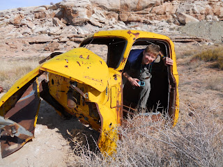
Have you already been to Moab, Utah? Numerous times? Want something new? Try the Yellow Cat Mining District located northeast of Moab. This place is deserted and has some amazing and odd scenery with reminders and relics from the by-gone era of the uranium mining boom. Some of the mining claims are still active, but the place seems like a ghost town. There are a ton of dirt roads to explore heading in any direction you want to go. We picked up some USGS topo maps to keep track of our location and travels, although they were missing a number of existing roads which made route finding difficult in some places. If you only want to buy one quadrant, buy the Mollie Hogans map. This one shows most of the hot spots and larger mine locations. There is a great website with downloadable versions of the topo maps at the Utah GIS Portal: http://gis.utah.gov/download
We took a nice hike along some 4WD dirt roads into the backside of Arches National Park. It was probably a 3 mile hike from camp to the park boundary. Lots of prickers and thorns on the trail, but a nice hike. Riley got a little tired of getting thorns in her paws, so she got a shoulder ride for a ways. She is getting pretty good at perching herself on the backpack.
We would definitely come back to this area. We only saw one other couple in the area the entire weekend. This is a great place if you want some space and enjoy the open vistas as a change of scenery from the beautiful red rock cliffs of Moab.


