We spent a great weekend in the Needles District of Canyonlands National Park. We were hoping to get a spot at the Squaw Flats Campground inside the National Park, but by the time we got there (around 4:30 p.m. on Friday) the campground was full. The Ranger directed us to the closest campground outside of the park known as Hamburger Rock. This campground is about 5 miles south of the park and 1 mile in on the dirt road to Lockhart Basin. The campground only has 7 campsites nestled in and under the rock outcroppings of hamburger rock. We were lucky enough to get the last spot in the campground (site #5). The campground doesn't have any services, but does have a nice pit toilet, and each campsite has a fire ring and picnic table.

The Needles District of the Canyonlands National Park is known for its pointed rock formations resembling "needles." I'm not sure I see the connection, but supposedly that is how the park got its name. The park has some great vistas and a lot of anasazi indian ruins and petroglyphs. The most famous petroglyph is Newspaper Rock. We had a great time exploring the sites.
We didn't bring the dogs on this trip since they are not allowed on the trails in the National Park. It was hard to leave them at home, but it sure freed up our time to hike and bike for as long and as far as we wanted.
On Saturday, we attempted to bike Elephant Hill, one of the most difficult 4x4 routes in Utah. This ride is insane. It was frightening just walking the trail. I can't even imagine trying to drive a vehicle up and over some of the rocks, stairs, drop-offs and cliffs encountered on this trail. The only reason we did this ride is because it is in a mountain biking book I have that I bought back in 1990. I am trying to ride every trail in the book, and Elephant Hill was on the list. Needless to say, Elephant Hill is NOT listed in any of the mountain biking books printed today.


The author of the mountain biking book said it was "unclear" why the hill was called Elephant Hill and that its naming origins are uncertain. After riding the trail, it is obvious how the hill got its name -- as it is one beast of climb that resembles going straight up an elephant's trunk, across its bumpy head, across its back, and then straight down its butt. Case closed. Despite the sheer terror of climbing and descending the elephant, the ride out to Devil's Kitchen and the backside Chestler Park was amazing with a great view of the needles area. The ride was only 9 miles, but it took us about 3 hours to get through it. I suppose I would do it again -- just for the views of Chestler Park -- and the adrenaline rush of walking your bike straight down an elephant's butt.


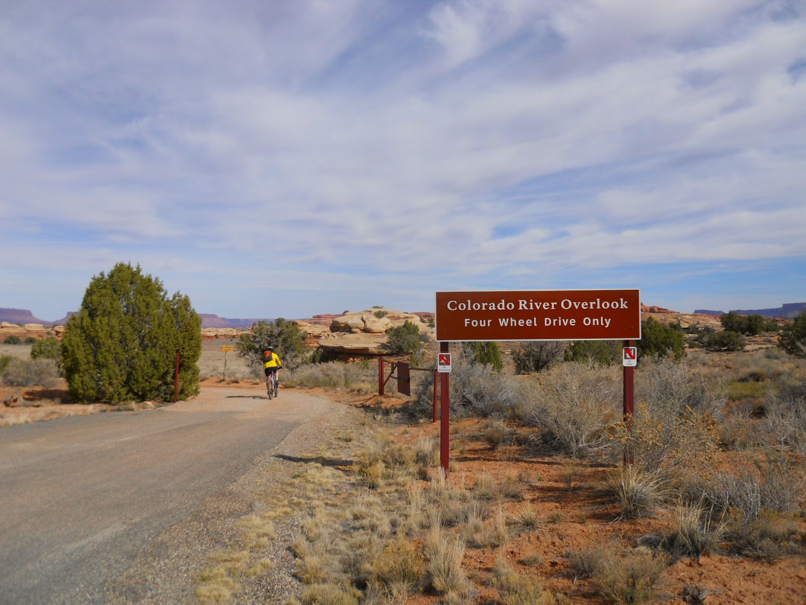
On Sunday, we did the much more reasonable Colorado Overlook ride. This ride starts out at the Visitor's Center and follows a sandy dirt road across some desert meadows, accross Salt Creek, and then up a rocky embacnkment to an amazing overlook view of the Colorado River. The ride wasn't as sandy this time of year and seemed easier than the last time we did it (7 years ago!). The 14 mile out and back took us about 3 hours (including the time it took us to change a flat tire on my bike).
I can't wait to get back to Needles. It was a great weekend and the scenery was stunning. If Squaw Flats Campground is full again the next time we come, we might try staying at the Needles Outpost (a private campground just outside the park boundary), or just dry camping somewhere along Lockhart Basin road. There were lots of great sites along this road, which appeared to be drivable with a trailer in tow for a couple of miles in from the main highway.
 |
| Conquered Elephant Hill |